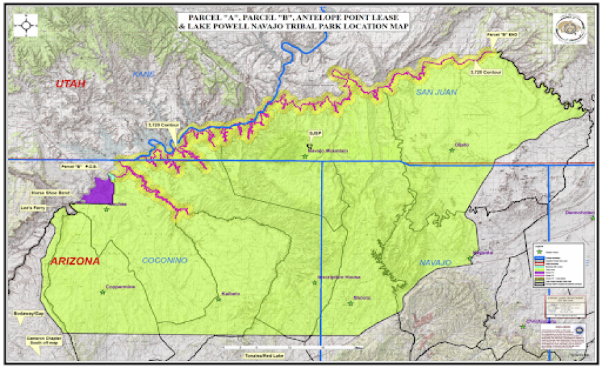
Lake Powell has always been a sore spot for some Navajo people, according to Navajo Nation Council Delegate Paul Begay. He said many families lost farming and grazing land when Glen Canyon was filled with water in 1963.
“I think the loss of pasture lands and land usage is what bothers our people the most,” Begay said. “And then, of course, not having any say in what was going to happen.”
That feeling of powerlessness continues today, thanks to a 50-year-old agreement regarding the co-management of Lake Powell. The Quadrilateral Agreement involves the National Park Service, which oversees the management of Glen Canyon Recreation Area and Lake Powell, as well as the Navajo Nation, Bureau of Indian Affairs and Bureau of Reclamation.
It was supposed to help the Tribe benefit from tourism to Lake Powell. But Begay said the 1970 agreement has actually kept them from developing the shoreline, because the park service has jurisdiction over a buffer zone surrounding the lake.
“It states that the National Park Service will help the Navajo,” he said of the agreement. “So in our mind, that turned out to be completely opposite of what it’s supposed to do.”
The agreement was set to expire Friday, Sept. 11, but the park service agreed to a year-long extension at the request of the Navajo Nation, which hopes to renegotiate the contract to account for changes to the landscape over the past half-century and to benefit the Tribe.
The buffer zone surrounding the lake is one of the biggest issues with the current agreement, according to Floyd Stevens, a former council delegate and chapter official. It starts at the elevation of 3,720 feet, along the shoreline of the lake, and extends out for one mile on tribal land.
Technically, anything below that level belongs to the federal government, due to the 1958 legislation in which the Navajo Tribe gave up the land used to create Lake Powell and Page, Arizona. in exchange for land in San Juan County, Utah. But the water level has receded from 3,720 feet since the Quadrilateral Agreement was signed, uncovering more land that the park service now technically controls.
“The Navajo Nation, I feel, should have full jurisdiction,” Stevens said of the land on the Tribe’s side of the lake. “What we build on the solid ground on the Navajo side should be up to us.”
Stevens is part of a committee tasked with studying the impacts of the agreement and making recommendations for how it should change. The effort started in December 2018, he said, after issues with the park service failing to uphold its consultation obligation under the agreement came to light.
Stevens said the committee met monthly throughout 2019 and in the first two months of 2020, but had to stop in March, because of COVID-19. The group plans to start meeting virtually again this fall. Eventually, they will deliver their suggestions to the Navajo Nation Tribal Council, which will try to negotiate a new agreement with the park service before the agreement expires next year.

Copyright 2020 KUER 90.1

